Navigating
Oak Island
By
James E. Bare - Primary Researcher
and
Howard R. Bare
Jan 1, 2024
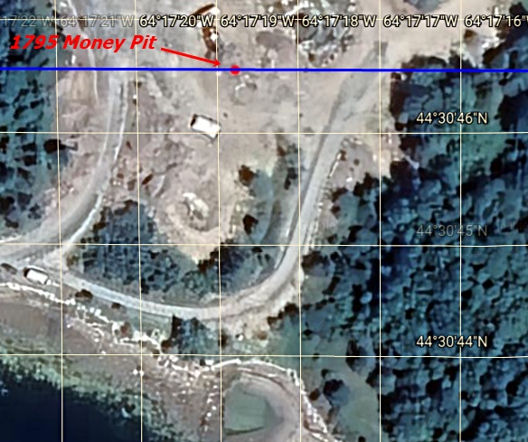
Google Earth has recently updated it's photos of Oak Island with much higher resolution, and more accurately placed Longitude and Latitude Lines. The Coordinates and Conclusions of this web page are unchanged, but as the longitude and latitude lines are moved, physical placement of the points on the island have also moved . Updated placements, and new material for this web site will be coming soon in this New Year.
Completely Revised June 4, 2023
Latest Update - October 25, 2023
The mystery of the Oak Island Money Pit goes back over 2 centuries to 1795 when it was discovered. The original location of the 1795 Money pit has been lost for nearly 150 years.
No one, until now, has been able to find it.
The material presented and linked on this web site is publicly provided for educational purposes. " Fair Use" is claimed for any copyrighted pictures or information on this non commercial web site. I would only request that if information from this web site is used, it be presented as a quote and credit given to its source. JB 8/3/2023
This web page is going to show and prove ( !) that the Stone Triangle and Nolans Cross are structures that function similar to the knob on the lock of a safe. The knob is in plain sight but what is the combination ? It might be said that this is one of the most complex and unique "safes" ever built. For this safe, one must recognize the two structures mentioned above as being part of a whole, and their purposes combine to create one outcome i.e., to open the door to the safe.. They are not independent structures. One must find the combination that exists between them to open the safe. Instead of using multiple numbers on a dial that is rotated, one must navigate their way . Like any ocean going ship, the course to its destination is found in the navigational combination of geographic coordinates used with trigonometry .
The
"combination" of this safe reveals two new points and their coordinates. One
of the points (K) is within the top portion of the Baby blob. The combination also
provides the potential coordinate location of the 1795 Money Pit as well.
Many have speculated that there could be multiple
potential deposits on the island. By opening this safe, three potential deposits
are revealed. Recent research on the island has revealed the presence of
gold in areas that are North of the 1795 money pit area especially in the
"baby blob". Gold in the ground water means that gold is open to
the water. The water around the 1795 Money Pit however, is
different. The small bits of gold chain brought up in 1804 could have come
from the Chappell Vault. If so, the Chappell Vault is a wooden box sealed in
concrete no evidence of gold in the water would be found.
Thus....there is actual physical evidence of at least two gold deposits on the island at
this time.
This solution shows and proves unequivocally that Nolans Cross is laid out in a highly accurate manner to it's intended purpose, and is highly accurately laid out to the True North Line from the Stone Triangle. The measurements of Nolans Cross as found by Fred Nolan are correct , and the distances between cones does not conform to a 144 foot interval or any other sacred or number or sequence. Nolans Cross is not a pareidolia ( that is, a natural arrangement) , it is definitely man made. As the Cones are aligned to their purpose, someone spent a lot of time and muscle power fine tuning the location of the Cones to produce the level of accuracy their purpose creates. Some say Fred Nolan built this with his bulldozer as there are "scrape " marks on them. All I have to say is, "show me the evidence ", but, there is none to show. The only evidence that exists , is that only after Fred measured the Cones in place, he moved some of the Cones ( A, B, and the Face Stone) with his bulldozer from the positions they were originally located. He admitted as much , but he also claimed he did not move Cones C, D , and E. Of course he didn't move the Kingdom Stone - as this buried stone was found by Petter Amundsen. Exact coordinate placement of all the cones is an absolute necessity. Thankfully, Nolan didn't move all the cones and took survey measurements of them before moving anything. The Stone Triangle was discovered in 1897, 28 years before Fred Nolan was born. By the time Fred arrived at Oak Island, the original location of the money pit was long lost. The important thing Fred Nolan did, was discover and survey the structure that now bears his name. Fred bought lot 5 and lots 9 to 14 in 1963. So Dunfield with his destructive methods, didn't touch the Nolan property.... where the Cones of the Nolans Cross are located.
Yes, the cones of Nolans Cross are slightly misaligned to each other and that slight misalignment has been calculated as shown below, but they align very accurately to their purpose. Their purpose is to interact accurately with the True North Line that comes from the Stone Triangle, and reveal two new points as well as the 1795 Money Pit. One point (K) consists of 4 lines whose terminal ends and intersections will fit within a 14 inch circle. The other point (Z) consists of three lines whose terminal ends and intersections are within 3/4 of an inch of each other. "Impossible" you the reader may be thinking ! However, the accuracy is there, and how such accuracy was achieved, and mathematically proven is discussed further down this web page.
Three
Points
Coordinates
of Point K ( At top of Baby Blob):
Latitude:
44 degrees 30' 47.33" N
Longitude:
64 Degrees 17' 18.8396" W
Coordinates
of Point Z:
Latitude
:44 degrees 30' 49.4518" N
Longitude:
64 degrees 17' 19.8513" W
Coordinates
of the Stone Triangle using its' Bottom Center :
Latitude
:44 Degrees 30' 43.6235"
Longitude
: 64 degrees 17" 18.8396"
Potential
Coordinate Location of the 1795 Money Pit :
Latitude:
44 degrees 30' 46.5864"
Longitude: 64 degrees 17' 18.8396"
The longitudes of Point K, The Stone Triangle, and The 1795 Money Pit, are identical.
Coordinates of the Cones of Nolans Cross:
Presented below, for the first time I believe anywhere, are the coordinates of all the Cones/Stones of Nolans Cross. The coordinates of Cones C, D, and E, were measured in place upon the island by Petter Amundsen and Brian Pharoah with identical measurements. The Kingdom Stone coordinates were measured in place by Petter Amundsen who discovered it. Coordinates for Cones A, B, The Face Stone, and Tau have all been mathematically derived based upon measurements made by Fred Nolan and the geometry of the Cross. A full explanation of Tau and it's presence is found in the linked document which is the complete version of this web page. Tau is found 136 feet from Cone E, or 429 feet from Cone D. Cone D of course , is 429 feet from the Face Stone. This document contains all the mathematics and proofs of what is presented on this web page. It is 37 pages in length. Just click on the link to open the document.
Complete Document with Mathematics and Proofs:
Cone A: Calculated from the position of Cone D , which was unmoved.
Latitude of Cone A is 44 degrees 30' 52.2858" N
Longitude of Cone A is 64 degrees 17' 27.7804 " W
Cone B: Calculated From the position of Cone C
Latitude of Cone B 44 degrees 30' 48.4914" N
Longitude of Cone B 64 degrees 17' 27.1122 " W
Cone C: ( From Petter Amundsen GPS - Brian did some rounding i.e. 54.67" and 32.08" and for me, that is not exact enough)
Latitude of Cone C = 44 degrees 30' 54.6688” N
Longitude of Cone C =64 degrees 17' 32.0797" W
Cone D: ( Petter Amundsen and Brian Pharoah GPS - identical measurements)
Latitude of Cone D = 44 degrees 30' 49.4518” N
Longitude of Cone D = 64 degrees 17' 34.6397” W
Cone E: ( Petter Amundsen and Brian Pharoah GPS - identical measurements)
Latitude of Cone E = 44 degrees 30' 48.0017” N
Longitude of Cone E = 64 degrees 17' 38.1258” W
Face Stone Coordinates:
Latitude of Face Stone = 44 Degrees 30' 51.5699 " N
Longitude of Face Stone = 64 Degrees 17'29.5132 " W
Kingdom Stone Coordinates: - GPS From Petter Amundsen
Latitude of Kingdom Stone = 44 degree 30" 46.5864" N
Longitude of Kingdom Stone = 64 degree 17' 41.5134" W
Tau Coordinates: Calculated from the position of Cone E
Latitude of Tau = 44 degrees 30' 47.33" N
Longitude of Tau = 64 degrees 17' 39.7510 " W
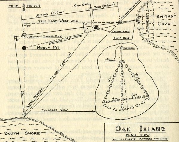
Coordinates
of the Westerly Drilled Rock :
44
degrees 30' 47.1886" N
64 Degrees 17' 18.8396" W
Coordinates of the Easterly Drilled Rock :
44
Degrees 30' 47.6958" N
64
Degrees 17' 13.10978"W
The photo below is the most accurately made public map of Nolans Cross that I know of. All other maps are either distorted,
inaccurate best guesses, or mis drawn.
Coordinate Placement of all Cones/Stones
The Accuracy of Nolans Cross:
An urban legend circulates that Fred Nolan moved the stones of Nolans Cross into position as a promotion to bring paying visitors to the island. Another urban legend is that the stones were placed by someone, but that Fred moved the stones so far out of alignment that they are now unusable. I decided to find out what was true and what was not. What follows are my findings and these finding disclose the truth. Below are the calculated physical misalignments of the cones C, D, E, and the Kingdom Stone . These 4 Cones were unmoved by Fred Nolan. The original coordinates for these 4 cones were measured in place upon the island by Petter Amundsen . The survey distances and placements were taken by Fred Nolan. Any deviance ( misalignment from an optimal positioning) is relative to the angle of the line they are located upon.
There is a physical alignment between the unmoved Cones/Stones in Nolans Cross that is quite accurate. The urban legends are falsehoods repeated so often as to be considered as true. They are not !
Deviation from the measured coordinate locations with Fred Nolans surveyed positions.
Cone
C: A 12 foot diameter Cone on the shoreline where it has sat
being pummeled by wave action and storms for centuries.
N-S variation of Cone C is 2.05 Feet or (.0203"
of latitude)
E-W variation of Cone C is 6 feet or (.0828" of Longitude)
Cones D and E:
N-S
variation between Cones D and E is 0.35 Feet ( 4.2 inches) or
(.0034" of latitude)
E-W variation between Cones D and E is 1.1 Feet ( 13.2 Inches) or
(.0151" of longitude)
To more clearly understand this. I used the longitude and latitude of cones D and E to determine the distance between the two cones,
Fred Nolan measured this distance at 293 feet. Using latitude - separation distance is 293.7 feet. Using the longitude, separation distance is
291.7 feet. Average of the two distances is 292.7 feet. Cones D and E are separated by 293 feet just like Fred Nolan claimed there were.
Kingdom Stone: This was buried under several feet of earth and tipped over on it's face.
N-S Variation from Cone E is 4.5 Feet or ( .0445" of latitude)
E-W variation from Cone E is 0.181 Feet ( 2.18 inches) or ( .0025" of longitude)
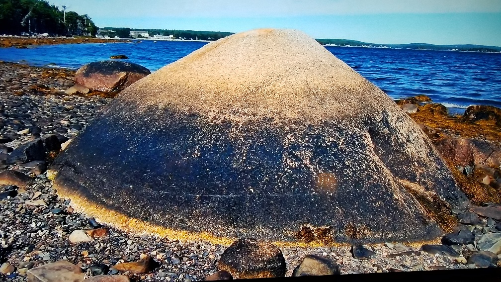
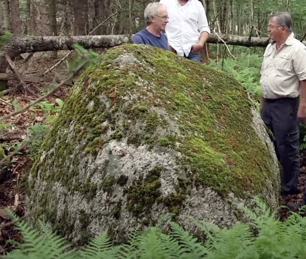
Below are photos of most, if not all, of the Cones of Nolans Cross
All photos are of stones identified as part of Nolans Cross
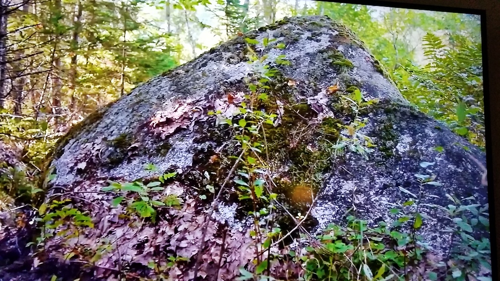
Cone C Unknown Cone
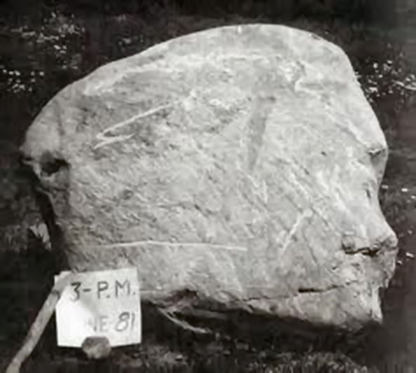
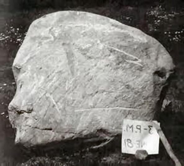
Face Stone Face Stone Flipped Cone E
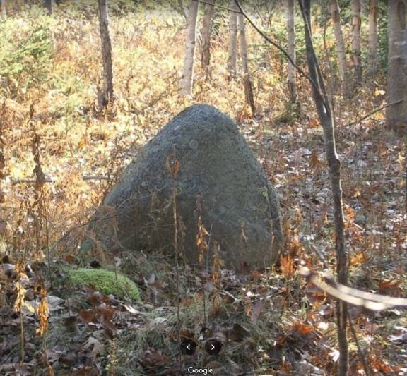
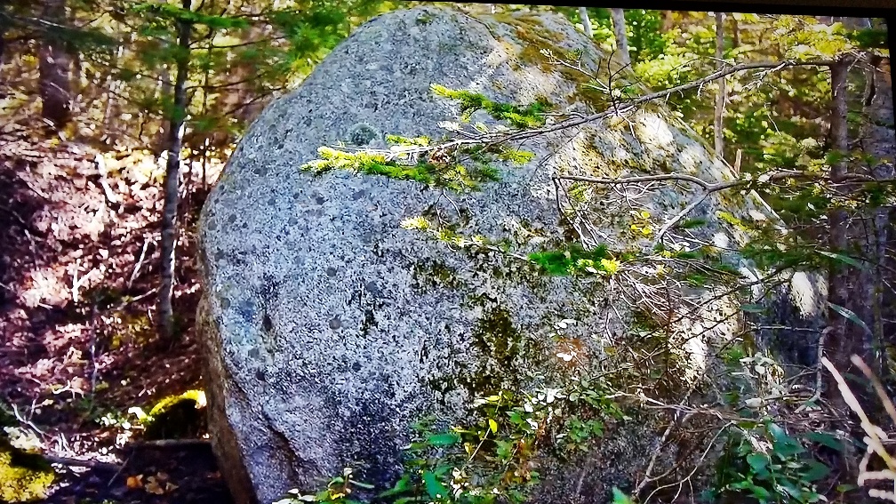
Unknown Cone Unknown Cone
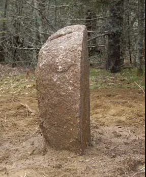
Kingdom Stone
[Split Red Granite Rock]
Point K
A Circle of 14 Inches:
The Cones of Nolans Cross , although seemingly slightly misaligned, are not , for they are highly accurately aligned to their intended use. The Cones can be used to draw intersecting lines. Two points of intersection of the lines are then revealed. Points of intersection that are extremely accurately placed. This fact deals the final blow to the critics stories regarding Nolans Cross. The Cones were not just some random set of boulders placed by nature, nor were they placed by Fred Nolan, nor were they moved so far out of alignment by Fred Nolan as to be unusable. The Cones are accurately placed by someone and are still usable for their intended purpose.
[A quick comment and disclosure . This solution is not the one I once posited from 2021 and 2022. It is related , but new, with different placement of the two points. My prior error was in the use of a 144 foot distance interval between cones, the use of a distorted screen capture of Nolans Cross, and not having all the coordinates of the cones. ]
If all that happened from my use of coordinates
and trigonometry to locate the Cones of Nolans Cross was that some lines intersected, that
would not have been anything more than an intriguing alignment. It was
necessary to determine via calculations, their exact intersection points ( the terminal ends of each
line) . Had their
intersection points been wildly different, This web site would have ceased to exist.
The fact is, the lines do align at their respective points with high accuracy.
That accuracy is a consequence of the care and detail the constructors of Nolans
Cross and the Stone Triangle took in creating and placing the two structures.
The first point, I call Point K. Point K consisting of 4 intersecting lines which
is shown below.
Calculated using coordinates, trigonometry, and a postulate of geometry (the
two angles q in this solution are
equal. ) , the terminal ends of all 4 lines that compose Point K are
within a circle of 14
inches diameter.
Four lines create Point K . First line is due E-W from Tau to K ( the latitude of point K ) , Second Line is Cone C to Cone A to Point K, Third Line is Cone D to Cone B to Point K, Fourth line is the Apex of Stone Triangle to K ( the longitude of Point K is the longitude of the Stone Triangle ).
Terminal Longitude Coordinate end points of the lines that intersect at Point K
5 different measurements that all terminate within 14 inches of each other - proof of accuracy of placement !
Cone C to Cone A to Point K 18.8461" W
Cone A to Point K 18.8461" W
Cone A to Point K using Tangent 18.830" W
Tau to Point K 18.830" W
Cone D to Cone B To Point K 18.8462" W
FWIW - Some of these lines are over 1/4 mile in length demonstrating the level of high accuracy in Cone Placement. Further, Coordinates Of Point K are within, and very close to the top of the Baby Blob.
Coordinates of Point K :
Latitude
of Point K : 44 degrees 30 minutes 47.33" N ( Same As Tau)
Longitude
of Point K: 64 Degrees 17' 18.8396 " W ( As the Stone Triangle
pointed directly to the Money Pit, This is also the Longitude of the Stone
Triangle)
(The distance of the line
between Cone A and Point K is not 864 feet but 818.967 feet.)
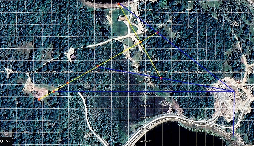
The 4 Intersecting Lines of Point K ( above)
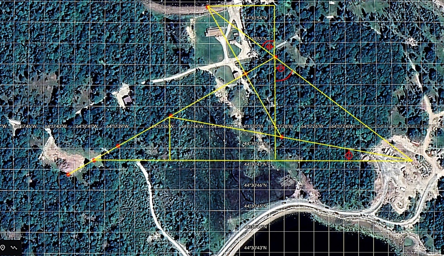
Shows the triangles and logic used to calculate the position of the terminal ends of the lines that create point K
The Second Point - Point Z
Point Z is the second point revealed from the intersecting lines. The Stone Triangle is shown playing its role.
Just like Point K, it was important to show that these are more than just alignment on a piece of paper, so calculations using coordinates and trigonometry were made.
The terminal ends of the lines at Point Z needed to be determined. There are two angles q in this solution. The angles are identical from the postulates of geometry regarding 2 parallel lines cut by a transversal.
Once calculated it was found that Point Z, is 1" of longitude further West ( actually 73.65 feet) than Point K. More Specifically Points K and Z are separated by 1" of longitude. 1" of longitude is 72.47 feet. 73.65 feet is 1.18 feet or 14.5 inches longer than 72.47 feet- the margin of accuracy for Point K .
Point Z is made up of 3 lines : First line is Kingdom Stone to Cone B to Point Z, Second line is Cone D to Point Z (which is the latitude of Point Z) , and the third line is the 7 degree angle line from the Stone Triangle to Point Z ( intersection point is the longitude of Z ). The Three lines terminate with 0.75 inch of each other ( 3/4 of an inch ) ! The terminal ends of the two primary lines ( Cone D to Z, and Kingdom Stone to Cone B to Z) were determined , and the terminal ends of 2 Secondary lines ( Kingdom Stone to Z and the longitude distance just from Cone B to point Z) were also determined, a total of 4 confirmations of Point Z, all line terminations are within 3/4 of an inch of each other.
Terminal Longitude Coordinate end points of the lines that intersect at Point Z
4 different measurements that terminate within 3/4 of an inch of each other - showing proof of alignment accuracy !
Cone B to Point Z 19.8515" W
Kingdom Stone to Point Z 19.8505" W
Cone D to Point Z 19.8515" W
Kingdom Stone to Cone B to Cone Z 19.8515" W
Coordinates of Point Z:
Latitude of Point Z : 44 degrees 30' 49.4518" ( same as Cone D)
Longitude of Point Z: 64 Degrees 17' 19.8513" W
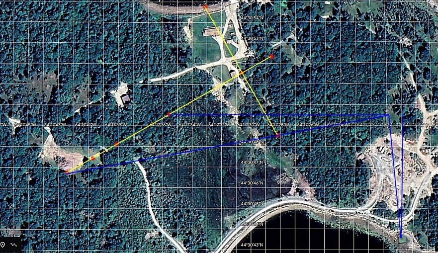
The Three Lines of Point Z ( above )
Shows the logic and triangles involved in calculation of terminal ends of lines that create point Z
Circulating stories about the Cones being moved and thus are unusable, about them being so far out of alignment even if not moved to be unusable, are just urban legends repeated so many times by so many people that people have accepted such as a fact. The Truth, is, as I have just proven, otherwise. Specifically, the cones are accurately placed and aligned. People have been mislead by those who made assumptions and then made unsupported statements about those assumptions. The result is that a blatantly false urban legend keeps being repeated and people are mislead wandering about in circles that go nowhere.
The Stone Triangle
Thanks to the destructive work done nearby it in 1971, the Stone Triangle has fallen into the sea and disappeared .
Here is how it is recreated. When it existed, it pointed true north towards the Money pit, thus, it's longitude is the same as Point K, and that is
64 degrees 17' 18.8396" W .
It's latitude is a simple calculation. As mentioned above, the two points K and Z are separated by 1" of longitude or 72.47 feet.
Given a triangle with a 7 degree angle and an opposite side of 72.47 feet, how long would the adjacent side of the triangle need to be?
The adjacent side of this triangle will provide the latitude distance from point Z to the Stone Triangle.
This distance calculates to 590.242 Feet from Point Z to the Stone Triangle.
590.242 feet/ 101.27 feet per second of latitude on Oak Island = 5.8283" of latitude difference from Cone D.
Latitude of Cone D is 49.4518" N
49.4518" N - 5.8283" = 43.6235" N
Coordinates of the Stone Triangle using its' Bottom Center :
Latitude = 44 Degrees 30' 43.6235" N
Longitude = 64 degrees 17" 18.8396"W
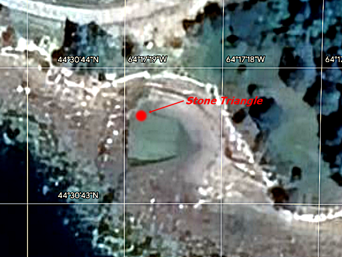
Location of the Stone Triangle
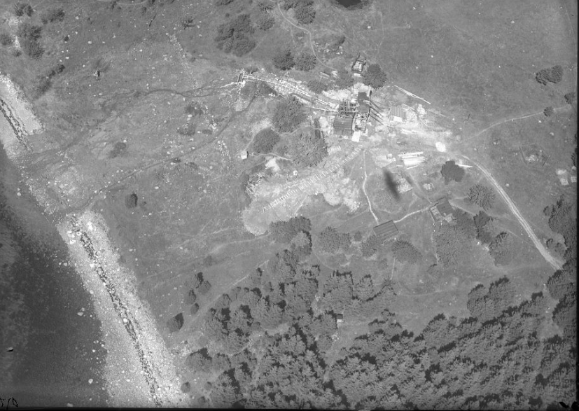
1931 aerial photo of the island and area of the Stone Triangle
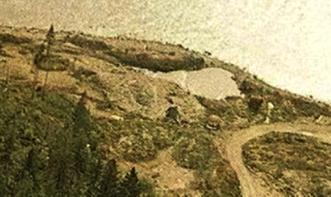
1971 aerial photo of the Stone Triangle area after Dunfield tossed a case of dynamite in a nearby shaft he excavated.
The 1795 Money Pit:
The actual location of the 1795 Money Pit
has been lost for over 150 years, but maybe there is a way to find it !
As Cone D and Tau are at the latitude of points K and Z, the question
arises, "is there a latitude
of one of the Stones of Nolans Cross that might correlate and help locate the
long lost 1795 Money Pit ? "
The Stone Triangle plays a role in locating the original money pit as it is known it's true North line points directly to the 1795 Money Pit, we know that it's longitude is at 18.8396" W. This longitude then will also be the Longitude of the 1795 money pit.
As for the latitude, we know that Tau on Nolans Cross is at 47.33" N which is too far North. Both Cone D and Cone E have latitudes that are too far North for the 1795 Money Pit. But, the Kingdom Stone, has a Latitude of 46.5864" N which is a very good fit.
As the Longitude of the Stone Triangle is known, and the latitude of the Kingdom Stone is known, the potential location of the 1795 Money Pit is simple.
Potential Location of the 1795 Money Pit :
44 degree 30' 46.5864" N
64 degrees 17' 18.8396" W
The question arises " Is there any way to confirm these coordinates?". The answer is "Yes ! "
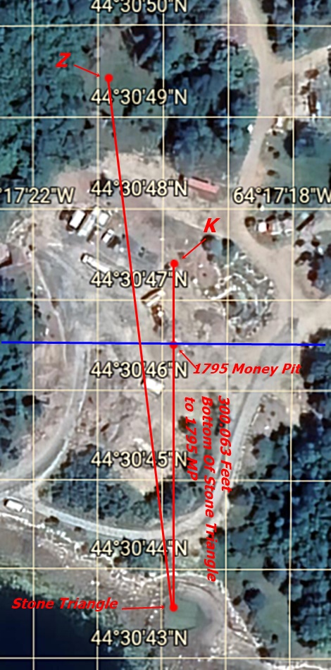
First, one must determine the distance from the bottom of the Stone Triangle to the 1795 Money Pit
Using the coordinates above, the distance from the Stone Triangle to the latitude line of the Kingdom Stone must be determined. It is known that the latitude distance of The kingdom Stone to the Stone Triangle is 590.242 Feet. What follows are the simple steps and calculations involved.1. Latitude Separation distance between cone D and the Kingdom Stone
Latitude of Cone D = 49.4518" N
Latitude of Kingdom Stone = 46.5864" N "
49.4518" - 46.5864" = 2.8654 "
2.8654 x 101.27 feet per second of latitude = 290.179 feet difference between Cone D and the Kingdom Stone.
2. Latitude Distance from the Stone Triangle to the Kingdom Stone. This will give distance to the 1795 Money Pit
590.242 feet
-
290.179 feet = 300.063 Feet of distance
between the bottom of the Stone
triangle and the 1795 money pit ( latitude of the Kingdom Stone) .
Confirmation of the coordinate placement of the Stone Triangle and the 1795 Money Pit
Surveys of Oak Island were done in the mid 1930's. Many decades before the massive destruction of the island occurred in the 1970's. The surveys were done before Fred Nolan arrived on the island as well . This survey can be used to determine the latitude and longitude of the Westerly and Easterly Drilled Rocks. It can also be used to determine the distance from the 1795 Money Pit to the bottom of the Stone Triangle.
I am placing all the math for this into my document " Constructing the Safe of Oak Island" . This document is not yet completed but will be linked from the web site when it is finished.
The Coordinates of the Two Drilled Rocks Are:
Easterly Drilled Rock Coordinates
Latitude of 44 Degrees 30' 47.6958" N
Longitude of 64 Degrees 17' 13.10978"W
Westerly Drilled Rock Coordinates::
Latitude of 44 degrees 30' 47.1886" N
Longitude of 64 Degrees 17' 18.8396" W
The Distance from the Stone Triangle to the 1795 Money Pit using a hybrid solution with coordinates and the surveys is :
300.0583 Feet
At the beginning of this section of the web page, it was shown that by using just the coordinate based solutions, the distance from the Stone Triangle to the 1795 Money Pit is 300.063 Feet
The Two distances differ by just .0564 of a foot, a little less than 1/16th of an inch !
The accuracy of the construction done on Oak Island has once again been demonstrated. Based upon the Surveys, the coordinates of the Stone Triangle and the 1795 Money Pit are correct. The Apex Stone of the Stone Triangle was used as a Cornerstone or what is also known as a Survey Marker. Everything was built in alignment to this one point. To consider, is this. Petter Amundsen took his measurements of Cone D and the Kingdom Stone in the 21st century, 70 years after the surveys. Those coordinates play a part in my hybrid solution.
If
Cone D or the Kingdom Stone had been even a few feet N or S, Petters
coordinates would have reflected this. The surveys and my proof would
show those discrepancies and not align. But ! The distances as shown
in the surveys, and the as measured in place coordinates of the Cones of
Nolans Cross, do align, and they match very closely !
Further proof that the cones C,D,E, and the Kingdom Stone as I have previously proven, were not moved , that they are aligned to their purpose, and there was great accuracy throughout the constructions.
Obtaining Accuracy Via The Construction Process
How was such accuracy obtained ? The answer is simple! A Cornerstone was first set and aligned or another way to consider it a stone was marked with a central survey point. It became a survey marker. All construction was accurately aligned to the position of that one stone. In working things through , I had to begin my proof using Nolans Cross, as the Stone Triangle was destroyed. As discussed above, the Stone Triangle was recreated and restored to it's place on the island and it's purpose. I got to thinking about how the actual construction would take place and it became obvious that I believe that the apex stone of the Stone Triangle was the corner stone. In 1957 Mr. Laverne Johnson uncovered the stone triangle and discovered a mark he found upon the apex stone. To quote Mr. Johnson " It was a plain little X or cross, about three inches from tip to tip of the arms and carved about three sixteenths of an inch deep and about a quarter of an inch wide, neatly done and unmistakably man made." The apex stone was set and marked, and became the cornerstone. The Stone Triangle pointed True North. As it pointed True North, the Stone Triangle defined it's own longitude. True North is not magnetic North. Magnetic North drifts with time. But True North is fixed at the planets central axis and does not move. It is always the same.
The Cornerstone
Apex of Stone Triangle from the Le Roy Crooks Film of 1939
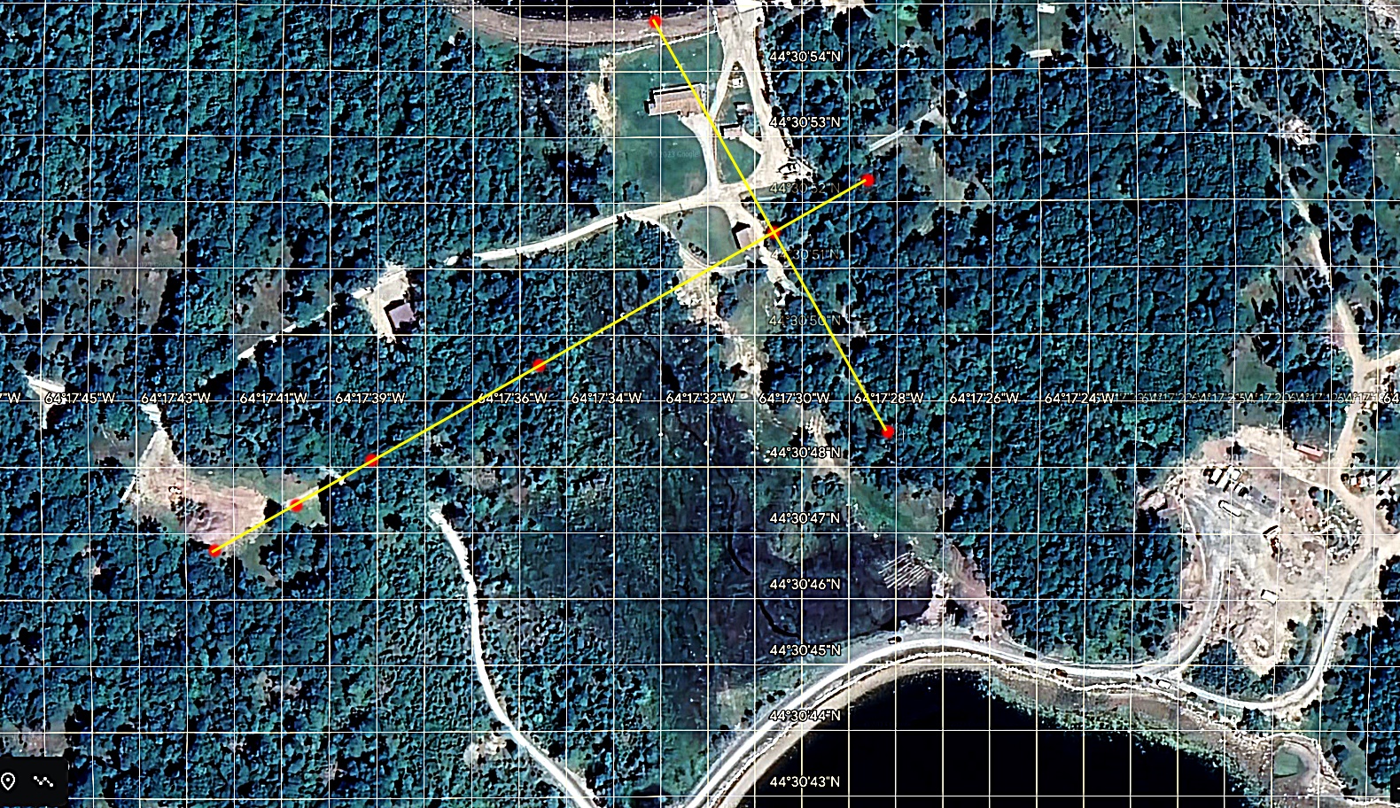
Below is the same survey from above, but with many of the survey lines erased. The red line from the Westerly Drilled Rock to the Sump Hole and the red line from the Money Pit to the Sump Hole are the same as the dotted lines shown in the survey above. The revised photo clearly reveals the alignments of 10 points to the Survey Marker/Cornerstone on the apex stone of the Stone Triangle.
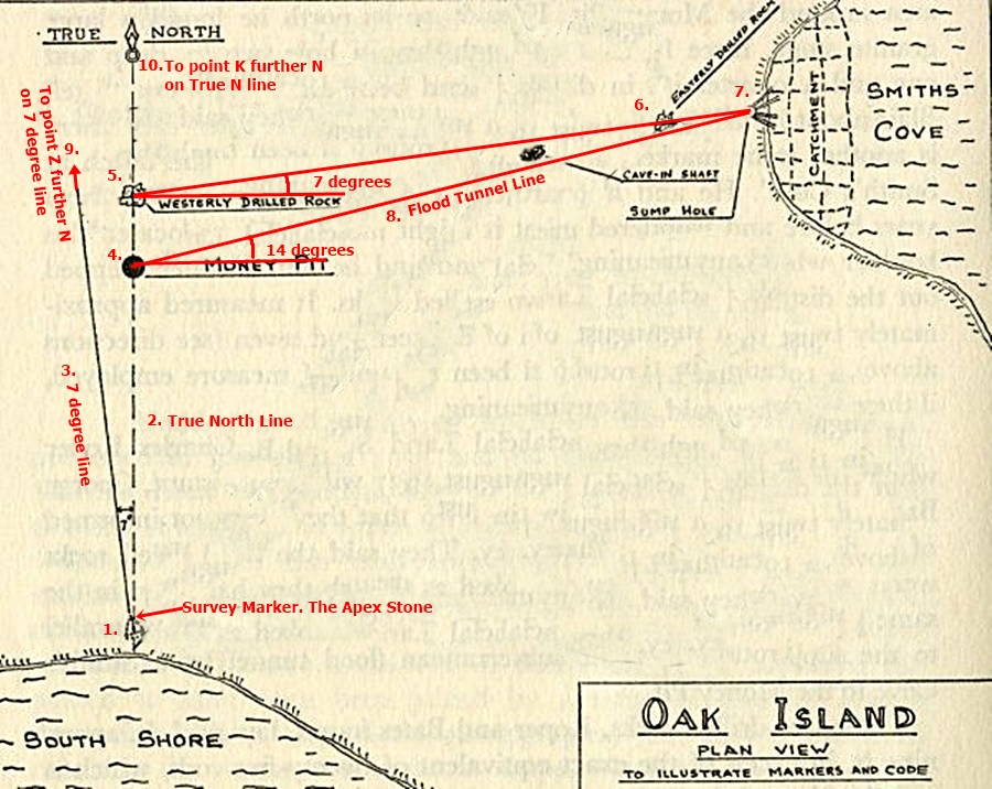
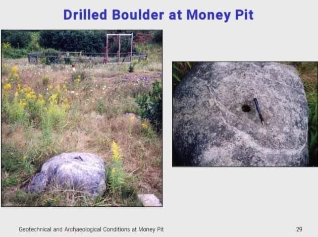
It seems highly likely that the vertical drilled holes in the Westerly and Easterly Drilled Stones were used for a monopole ( not tripod) survey instrument placement.
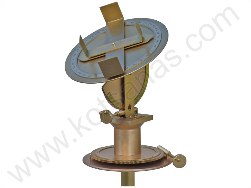
Dioptra
A highly accurate instrument, that gave precise measurements of vertical, and horizontal angles. It was used in construction
to provide precise alignments. With some mathematics, angles can be used to determine
vertical and horizontal distances between both celestial and terrestrial objects.
Placing the Position of The True North Line on the Island
Due to the importance of the position of the True North line upon the island, how was it's placement determined ?
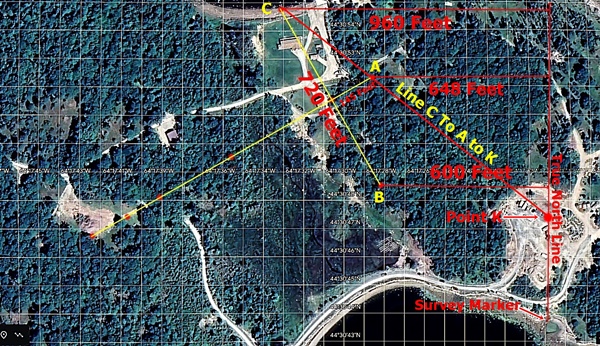
I found the answer by checking the distance from the two cones C and B on Nolans Cross to the True North line. I used the longitudes of Cone C and Cone B and found that Cone C is 960 feet from the True North line, and Cone B is 600 feet from the True North Line. Accurate longitude measurement outside of Europe was impossible before the early 1800's , so just some sort of linear measurements were used. Distances are in Fathoms - 6 foot intervals. The entire construction of the island began at Cone C. Either Cone C was naturally in place, or was set in place.
Steps:
1.Take a latitude
measurement of C, then go True East 960 feet. Take another latitude measurement
to set the end of the line at the exact Latitude of Cone C. This will provide an
accurate right angle to a True North line. As a
comment - Some may think that latitude measurement going
back centuries well before GPS, might not have been so exact. This is a wrong
assumption. There is an
example within Nolans Cross of extreme accuracy in latitude placement , and that
is Cone E. Cone E is found at 48.0017” N. This is an accuracy of .0017 " of
latitude , which is within 2 inches of perfect alignment !
2.Set a 60 degree angle from Cone C and go across the bar at a 60 degree angle
from C, 720 feet, and set Cone B. Then take a latitude measurement
of Cone B.
3.Go True East 600 feet from cone B and set another point at the same
latitude as Cone B. This will make the 600 ft line form a right angle with a
True North Line.
4. Then carefully align the two points from the two cones C and B, so that they are on
the same True North Line ( not slightly East or West of each other) . That sets the
longitude position of the the Survey Marker, and thus the longitude of the True
North Line.
5.Go down across the cross bar 360 feet to it's middle. Measure the latitude of that point. This point will also set the main body line of Nolans Cross at 90 degrees to the Cross Bar.
Run a True West Line from the mid point of the cross bar 780 Feet at the same latitude. This will create a third point

From this process, all 10 points in the survey and all the cones on Nolans Cross are aligned to each other, they become accurately placed, with no need for longitude measurement ! Just basic surveyor tools and careful accurate latitude measurement. There is yet one more "anchor" Cone that secures and accurately locates Nolans Cross to the True North Line, and that is Cone A. The stone at the top of Nolans Cross.
Why Cone A is 145 Feet from The Face Stone
There has been a lot of conjecture about the placement of Cone A and it's distance of 145 feet from the Face Stone.
There are two reasons for this placement:
1. The longitude distance between Cone A and the True North line is 648 feet.
Longitude of Cone A is 27.7804" - 18.8396" is Longitude of True North line = 8.9408" of longitude difference
8.9408" of longitude X 72.47 Ft/second of longitude = 647.9397 Feet or 648 feet
Yet another Fathom ( 6 Ft) measurement interval ! 144 feet, 147 feet and so on would not provide the correct distance between A and the True North Line , as they would not be a 6 ft interval. I've just described how the True North line position upon the island was determined and then set. In an identical manner, the placement of Cone A can also help to locate the True North Line from the apex of the Stone Triangle. Importantly, just as Cone C and Cone B accurately align the cross bar to the True North line, Cone A's placement at 145 feet from the Face Stone, accurately aligns the main bar of Nolans Cross and all it's Cones to the True North Line .
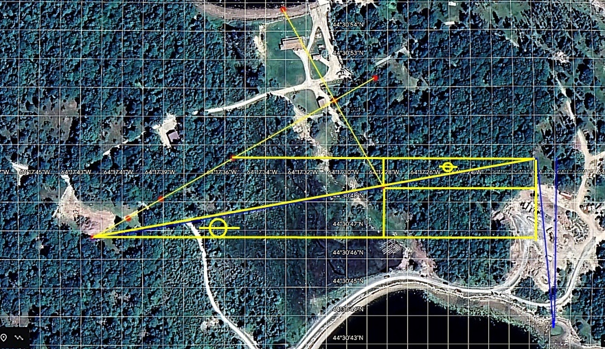
2. A 145 foot distance also aligns the line that goes from Cone C to Cone A and then onto Point K as shown in earlier on this web page . This line exactly intersects with three other lines that make up point K. Thus Cone A is also aligned to Cone C. Distances such as 147 feet and 144 feet for example were evaluated, but the line would not accurately intersect with point K . Below is a photo of this.
Conclusion
To summarize , the process I followed was this :
1. Coordinates of all cones C, D, E, and the Kingdom Stone of Nolans Cross were obtained - Taken by Petter Amundsen and Brian Pharoah
2. The missing coordinates of Cones A, B, the Face Stone, and Tau, were calculated using Fred Nolans measurements.
3.These coordinates were placed on a map taken from Google Earth
4. It was found that lines drawn from the Cones of Nolans Cross terminated in two unique points. People have been doing this for years, but with inaccurate maps and only showing one point ( of no reliability due to inaccuracy) where their lines intersected.
5. The place of intersection - where the lines terminated for each point, was calculated and coordinates determined. High accuracy was found to exist between the lines and their points of termination .
6. As the Stone Triangle was known to point directly at the money pit , the longitude of Point K is also the longitude of the Stone Triangle.
7. The separation distance between Point K and Z is 1" of longitude. A calculation was made showing the distance from the Stone Triangle the 7 degree angle lines would be separated by 1" of longitude. This distance is the Southern placement of the Stone Triangle.
8. The placement of the 1795 Money Pit was presented.
9. Corroborative proof of correct coordinate placement of the Stone Triangle and the 1795 Money Pit was found using island surveys taken in the early 20th century.
10. The alignment and inter relatedness of 10 structures on Oak Island to the True North line that originates from the Survey Marker at the apex stone of the stone triangle was shown.
11. How the True North lines placement on the island was determined using the positions of Cones C, B and A, and how the two bars that make up Nolans Cross were placed demonstrated. Construction began from Cone C. Cone C was used to set the longitude position of the True North Line . This process set all parts of the constructions on Oak Island in alignment to each other, and all were based upon the True North lines longitude placement. This is how the high degree of accuracy of the structures on the island was accomplished.
12. The reason for the use of 145 foot distance from Cone A to the Face Stone was presented.
13. The design plan of Oak Island has now been revealed.
The Genius of The Design:
The Survey Marker set the primary alignment Longitude , and all constructions on the island was accurately aligned to this one Longitude. This includes the placement of : the Stone Triangle, the True North Line, the 1795 Money Pit, the Easterly and Westerly Drilled Stones, the Sump Hole for the Box Drains, the Box Drains, Smiths Cove, the Flood Tunnels from Smiths Cove, the 7 Degree Line from the Stone Triangle, points K and Z, Nolans Cross, and the Cones of Nolans Cross - both visible and buried. It was of absolutely no consequence that the longitude coordinates of the True North line and all the constructions aligned to it were unknown ! With today's GPS, longitude determination is a simple process and has helped to unravel the mystery of the construction. With the construction process now revealed, one can see how all the constructions are aligned interrelatedly and also accurately to this one longitude. The genius of the design of Nolans Cross is that it is set at a 30 degree angle. This makes the placement of the cones on Nolans Cross a simple process. Cones C, B, and the Face Stone were first set. Then the main bar of the Cross was laid out starting with Cone A. From Cone A, the Cones D, E, Tau, and the Kingdom Stone were placed. All the Cones of Nolans Cross became accurately placed to the True North Line. A Genius solution to an otherwise significant problem of longitude determination !
As a method to conceal something of value, the designers plans are superb. The designs intention is that once built, the deposits are completely concealed. Without guidelines, or a set of plans, one has no understanding. There would, and has, only been the knowledge that something was hidden within the island at the 1795 Money Pit. Even if the 1795 Money Pit had been excavated and a treasure found, the other two points Z and K would remain unknown ! Relocating the two points K and Z, and also finding the now lost location of the 1795 Money Pit, is an intentionally designed in conundrum. A riddle, that is diabolically complex and confounding. Without a set of plans or understanding of how it was built, locating the three points is, and has been , impossible. The mystery has been unsolved for over 225 years. It wasn't until the cumulative discoveries of the past 125 years that a solution could be arrived at. The Welling Triangle , the Surveys done in the early 20th century, Nolans Cross, Petter Amundsen's discovery of the dual purpose of Nolans Cross with it's hidden Kingdom Stone, modern GPS, and Google Maps have all been required for the solution. Intuitively, many believed there was some inter relationship to all the stones of Nolans Cross. However, the separation distances are great. When those distances are combined with the seemingly crude placement of the stones, the possibility there was accurate placement inter relationships between all the stones was never considered. A wave of the hand dismissal, for it seemed impossible and crazy to think otherwise. No one really looked and evaluated seriously until we took the time to do so. The alignments are there, accuracy and inter relatedness of placement exists, and as has been shown and proven, three accurately placed points are revealed .
The question is of course "what is located beneath these three points ? "
This linked document contains all the mathematics and supportive proof for what has been presented. It is 37 pages long. Please click on link to open.
James and Howard Bare
6/4/2023